Tajikistan and the Pamir Highway
Driving the Pamir Highway, Tajikistan
Tajikistan embodied all the greatest aspects of overlanding adventure for us. It had vast open country, stark majestic mountains, a culture and history that was different and new for us to learn. Tajikistan provided remote and wild terrain, we could not wait to explore its high desert mountains and fulfill a lifelong dream of driving the Pamir Highway.
As with the neighboring countries of Central Asia, the Tajik people were warm and welcoming, but outside of the bigger cities tourism infrastructure was surprisingly limited. Family run homestays were the norm along the Pamir highway with groceries hard to find outside of very small convenience stores carrying dry goods, soda and cookies. ATM’s were scarce but gas stations were common enough to get us by with some planning.
We entered Tajikistan from Uzbekistan with our E-visas in hand. Although not technically required for us as US citizens, we found that applying for the E-Visa was the simplest way to get the GBAO permit online (required to drive the Pamir region). Total cost was $75 each for the visa and permit together. We were required to pay a $25 road tax for our truck at the border and insurance was $12 for a month.
Our 2100km route through Tajikistan
The first place we explored was the gorgeous Fann Mountain region.
Driving up the road of the Seven Lakes Valley
Wild camp with a view - the fourth of seven consecutive lakes
Sun goes down on camp while Dawn (with Andy's encouragement) poses a little awkwardly on the hood
The road was narrow - we were glad we only met one vehicle
Hiking around the seventh lake
Local villagers making bricks at a stream
Passing through villages, school children always beautifully dressed in black and white, the girls with huge white bows in their hair
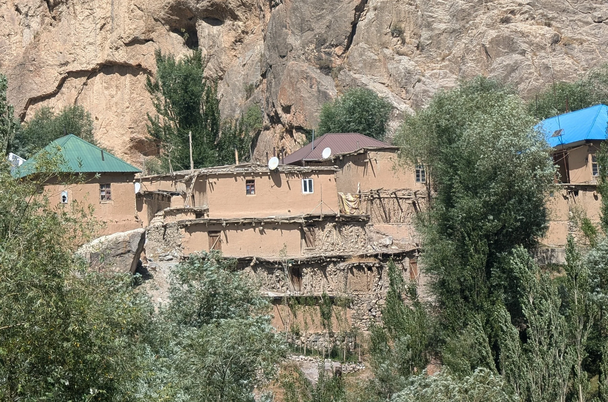
Traditional homes in the region
Some built into the cliffs
Some with beautiful designs in the walls
Navigating the narrow road along the cliffs
Each of the seven lakes a different, glorious blue
The weather was perfect in early September - clear and cool.
Another intricately designed home
People, especially children, in Tajikistan went out of their way to welcome us as we passed through their villages. Children would run out and wave and call out “hello” or “welcome!” We always felt safe, whether in the city or in a really remote area.
Women collecting hay
The cultural hospitality extended to the availability of wild sites to camp. We quickly realize that unlike some other places we have been, there was no need to try and hide. People often honked and waved, smiling as they drove by our camp.
Bluff top camp
The next drive we ventured on was into Alauddin Lake near Sarvoda. It was another area steeped in beauty, rural village life side by side with spectacular hiking and scenery.
More donkeys than vehicles on the road to Alauddin Lake
Another steep windy road - no surprise!
Hike to Alauddin Lake
It was a beautiful, mostly flat hike with a stunning backdrop
Carved door at a village home
Sunset view from camp
River side camp
That's a lot of goats in the road! Shepherds still moving the flocks before winter.
Drive back out from Alauddin Lake
Our souls enriched with mountain scenery and air, it was time to head to the big city to pick up our son, Nicholas. We were thrilled that he would be joining us on the road for a month. It was also an opportunity to re-supply the truck before we headed out on the Pamir HIghway.
Dushanbe was not our favorite city. It was easy to navigate with wide tree lined streets, orderly and clean. But it also felt inauthentic somehow. The downtown buildings were new and ornate, many displaying giant posters with pictures of the president who has been in power for 33 years and has a questionable human rights record. We did not delve into the politics with people but did do a free walking tour which felt like the most extreme example of whitewashing we had ever encountered. Our guide assured us that the country was perfect, the people were all happy, the president was great . . .
New government buildings in central Dushanbe
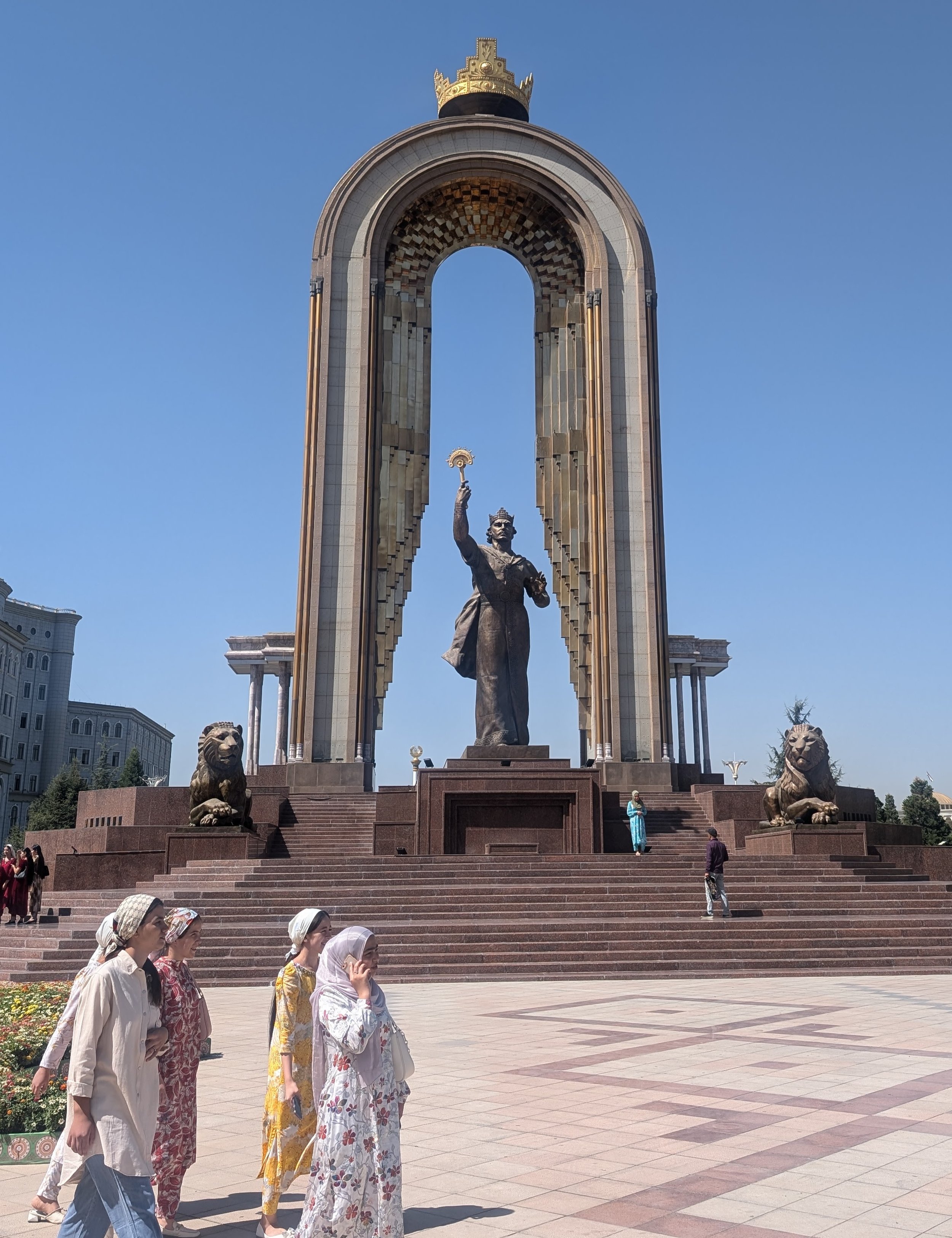
Monument to Ismail Somoni, a revered leader of the Samanid dynasty which included what is now Tajikistan in the early 900's.
School with poster of President Emomali Rahmon
The 3am pickup of Nicholas at the Dushanbe Airport was successful, and we set off full of groceries, gas and water to tackle the famous Pamir Highway.
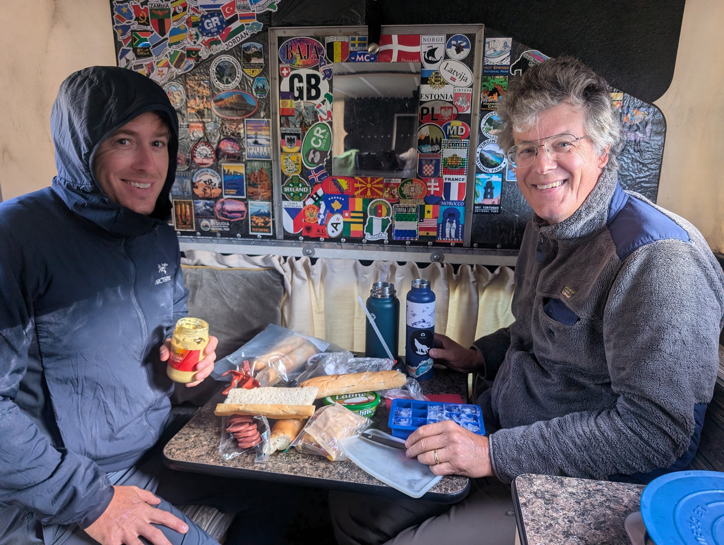
First picnic lunch with our son on board! Featuring local flat bread.
We miss our three children and were thrilled to have one of them on board with us for a while. Our truck is small and the third seat is cramped but for family we always have room.
Pamir Highway - Tajikistan Section
We kept detailed notes from our trip as we found it was relatively hard to get specific information about routes, timing, places to stay, etc. Below is our day by day breakdown in case it is useful to others.
Map of the Pamir Region and routes from the Caravanistan website, which we found to be an extremely helpful resource.
The classic Pamir Highway route goes from Dushanbe, Tajikistan to Osh, Kyrgystan. But there are a number of variations and side routes that people incorporate.
The first decision point upon leaving Dushanbe is whether to take the northern, Tavildara route (more remote and over a 10,700 ft mountain pass) or to go through Kulob which is a better road, slightly shorter in time but longer in miles (if you believe Google). As our weather was good and we always love the mountains, we took the northern route to Kalaikhum.
From Khorog, you can choose to take the direct Pamir HIghway route (M41) - the red route above - or head south along the border with Afghanistan for a more remote route. After speaking to locals and fellow travelers, we opted to take the southern, Wakhan Valley road - the brown road above - which locals commonly refer to as “the real Pamir.”
We took eleven days to go from Dushanbe, Tajikistan to Sary Tosh, Kyrgystan. We did not continue driving north to Osh at this point, but peeled east to enter China. We were traveling the Pamir route Sept 11- 20, 2024. As far as weather, we felt like this time of the year was ideal. Still warm enough, past the summer months of tour group travel (it is limited but we did see a few groups of tourists in hired vans with drivers), but before snow and cold becomes an issue.
Day 1 - 165 km, 4.5 hours of driving
We left Dushanbe at 11:30am, arrived at camp about 5pm. (We were using iOverlander to find wild spots to make sure we didn’t accidentally camp somewhere we were not supposed to. ) The more northern route (blue road on map above) was mostly decent, but at times deteriorated to gravel and forced us to reduce speed to about 15kph.
In general, along the route we drove, road conditions were rough enough to slow you down (gravel, if asphalt then potholes to watch for) but never severe enough that you needed hardcore 4x4.
Throughout this first day, the scenery got better and better as we approached the mountains and started passing through canyons.
River side camp along the road from Dushanbe to Tavildara. Grey tent is NIcholas's bedroom.
Day 2 - 178km, 7 hours of driving
On the second day we drove over the mountain pass and through Kalaikhum (shown as Qalai Khumb on map above). A big challenge for overlanders during this time was massive construction delays on the Pamir Highway stretching from south of Kalaikhum to Khorog. Someday, maybe in a year, the road will be smooth going, but for now traffic is stopped for anywhere from 2-6 hours intermittently along the way as construction crews blast out the rock cliffs to widen the road. Locals advised us to get up early and try to get as much of the road as possible before crews showed up at 8am.
We decided to go as far as possible even though we were driving in the afternoon and hit a construction roadblock mid afternoon, but luckily only a 90 minute delay until crews knocked off for the day.
We left at 9am and pulled into camp at 6:15pm (including the 90 minute construction delay). At this point, we had started driving along the Tajikistan/Afghanistan border. It was sobering to look across the river that separated the two countries and think about the history of violence and strife - both between them and between our home country and Afghanistan. We watched as children played on farms across the river and villagers worked their fields.
The Tajikistan military were very active along this section. There were regular military check points (just friendly passport checks), frequent military bases and patrols. People were not allowed to camp along the river in open view of the road, the Tajikistan military insisting it was not safe because of the Taliban.
We found a wild camping spot tucked out of sight up a side canyon.
Nicholas getting in on the daily routines - first thing in the morning, make a picnic lunch
Road up to the mountain pass - nice gravel at this point
Happy family photo at the top
Regular military patrols along the border with Afghanistan - the border is the river
Nice to have a third driver to switch off with all the driving!
Construction delay - everyone just sits and waits
Riverside canyon camp
Day 3 -144 km, 5 hours of driving
We managed to get out of camp early - 6:15am and get through the rest of the construction zone with no delays. Having spent a couple of long hard driving days, we headed to Jizeu Valley for scenery and hiking. We arrived at 1pm (having taken an hour break after the construction to make some breakfast). We chose a spot 28km out the Bhartang Valley road (green road on above map). Jizeu Valley is a side canyon hike off of the Bhartang Valley road.
Looking across the river to villages on the Afghanistan side
Scenery across the road
Driving up Bhartang Valley
Bhartang Valley road - along a glacial river
Now we get to take pictures of our son in addition to pictures of the truck
View from camp
And who should pull up to say "hi" but a French overlander with a Toyota Tacoma with a 4 Wheel Camper!! He ordered both from the US.
Nicholas taking his turn in the "resting nest"
Like father like son, they happened to each have the same baseball cap
The sun goes down on camp
Day 4 -Jizeu Valley hike, 90km and 3.5 hours of driving
In the morning we headed across the REALLY long suspension bridge to hike into Jizeu Valley - we hiked 9 miles roundtrip, making it to the first village and lake. After the hike we had a relatively short drive to Khorog where we had booked a guesthouse.
Suspension bridge access to Jizeu Valley
Hiking up the valley - the villagers do this regularly, coming out to the road when they need to access outside supplies
Traditional village home. People were busy preparing for winter, piles of dung drying for fires, fruit and corn being dried on rooftops.
Nicholas heading to the lake to see what he can find
And then back over the bridge . . .
Although monochromatic, the scenery was stunning
Heading out of the valley back to the main road
Guesthouse view in Khorog - we booked a three person room at Hotel Zarya - received a warm welcome from the host and had a beautiful breakfast the next morning ($60 for the three of us). Average prices for guest houses along the Pamir seemed to run about $20-$25pp
Day 5 - 138 km, 6 hours of driving
We left Khorog at 11am after re-stocking a few groceries. We were already seeing a lot fewer food options than we had in Dushanbe (no surprise). Meat in the supermarket was limited to a huge variety of sausages and hotdogs (we chose not to buy meat from the local stalls hanging huge hunks of mutton and beef from outdoor hooks). Cheese was non existent, fruits and vegetables limited to bell peppers and apples we bought from local women on the street. We also filled up on water and gas as this would be our largest town for a week.
One regret we had about Khorog was that we were not there on a Saturday and so missed the Afghan market. On Saturdays Afghan traders come to an island in the river and people are allowed to cross the bridge to buy from them. We would have appreciated the experience but our timing was off.
From Khorog we continued south on what becomes the Wakhan Valley road, not officially the “Pamir HIghway” but still a Pamir road. This meant we would be continuing to hug the Afghanistan border for 100s of kms.
We were able to visit Khakh Kaka fort on our route which was a fascinating scramble over decaying ruins. We arrived at camp before 5pm.
More gorgeous scenery
Climbing up the bank to Khakh Kaka fort.
The fort was built into and around the natural rock formations
You could still see some of the ancient design elements
Villagers near the fort had way too much fun dressing Nicholas traditionally
View from camp, uphill from the river so far away from the border that the military was not concerned
Nicholas tucked in behind us as a wind break
Day 6 - 60km, one hour driving
This day was one of our favorite days on the drive incorporating a scenic hike, iconic old fort and hot springs.
We left camp at 9:45 and drove to the Darshai Gorge trailhead. This gorge hike is famous for its construction - villagers built a ledge by sewing branches rocks together. It allows them with access to winter hunting grounds and it provided us with a lovely hike. Two and a half hours round trip got us to the most famous part “the ledge.”
Standing on "the ledge" at the Darshai Gorge
Note that Dawn is not featured in any of these "ledge" photos
The next stop was Yamchun Fort, an ancient Silk Road outpost. The setting was awe inspiring but we were slightly sad to see that the fort was in the process of being fully restored, with new brick walls being erected on the old foundations. For us, with old buildings there is a sweet spot between full renovation and full ruin - we prefer just enough to get the imaginations going. But we understood the intent in terms of encouraging future tourism dollars.
Yamchun Fort, originally built in 300 BC
View from Yamchun Fort across to Afghanistan
Old walls still standing, not yet renovated
Petroglyphs on rocks in the fort
We have no photos of our last and possibly favorite stop of the day - Bibi Fatima Hotsprings. For a minimal fee, men and women enter separate hot springs in cave like rooms built into the cliff wall. It was relaxing and rejuvenating.
And after all that activity, family movie night in the camper
River side camp in view of Yamchun Fort
Day 7 - 100km, 4 hours of driving
Despite the rain this day (our first!) we were up and out by 9:30am, arriving at a 4th century Buddhist temple in the village of Vrang by 10:30am.
(As an aside, we were usually the only tourists at all of the ancient ruins we visited along the way. Signage was minimal as was cell coverage. Luckily we had downloaded maps on a variety of apps (Google, OSM, Gaia, Apple Maps) beforehand so we were always able to find what we were looking for, but it took a bit of work.
Hiking to the Buddhist temple, or "stupa"
Buddhist Stupa
Village girls who accompanied us
View across the valley from the Buddhist stupa
From Vrang, we drove an hour to the village of Langar and found the trail up the steep hill to the petroglyphs.
Traditional Pamiri homes along the way
Petroglyphs on the hillside above Langar
That's one big Ibex, a type of mountain goat
So much to look at
After a lunch break cooking up some noodles in the truck, we continued our way along the Khargush Gorge and eventually pulled into camp about 5pm. This day was one of our favorites scenically with far away views of the Hindu Kush range.
Driving the Khargush Gorge road
Wild camp along the river, cloudy mountains in the background. With the rain and cold it was the only night Nicholas came inside and slept on our dinette seats - he claimed it was comfortable.
Day 8 - 175km, 6 hours of driving
This was another one of our favorite scenery days. We completed the Khargush Gorge road, re-joined the M-41 (Pamir HIghway) and drove out to visit an abandoned Soviet observatory.
Mountain views along the way
View from the lunch stop where we re-joined the Pamir Highway M41
All of our supplies were dwindling so we were happy to visit the village well in Alichur and Nicholas manned the pump so we could re-fill our water tank.
Downtown Alichur. We had been hoping to buy some fresh groceries but no luck.
Back on the road
Abandoned truck at the Soviet observatory. full of Marco Polo sheep horns
Our "wild" camp tucked against an old Soviet building as shelter from the wind
Old solar telescope building
Nicholas having fun sorting through 40 year old memorabilia
Day 9 - 50km, 1 hour of driving
The next morning, we left the observatory camp, stopped by some ancient cave paintings and made our way to Murghab. At this point we were pretty much out of food, having eaten garbanzo beans and couscous the night before. (Getting down to the end of our dried good storage). We were happy to stay at Guest House Erali where Andy and Dawn parked in the yard behind and slept in the camper and Nicholas booked a room. Hot showers all around!
Heading back out of the valley where the observatory was
Side trip to see cave paintings
Dawn appreciating a rest in the sun
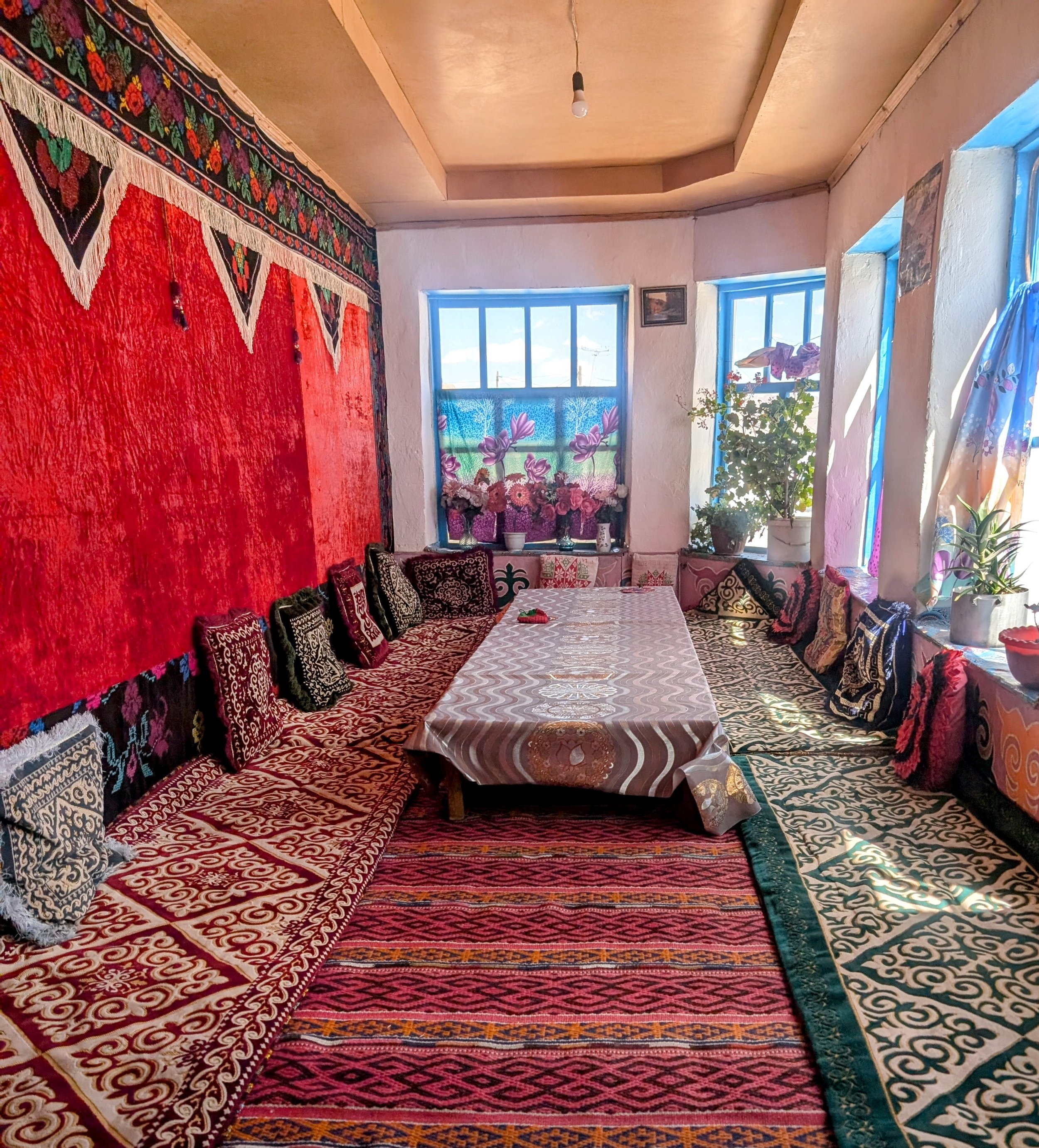
Murghab guest house, typical interior decor for Pamiri home
Home cooked Tajik dinner! See grandma chef at window. We were joined by a French cyclist and climber, riding 200km a day to Nepal.
Photo with our host (and chef) and her grandchild
Day 10 - 210km to Tajik border, 4.5 hours driving
We left our guest house with cheerful goodbyes and continued on our way to the border with Kyrgystan. (Another side note, known as the Kyzyl-Art border, this border requires a pre-registration for all travelers, we used a service, Destination Pamir, to do this for a cost of $15 per person. We worked with Erali who owns both Destination Pamir and the guest house - Erali Guest House - where we stayed in Murghab. It worked well for us - he sent us confirmation of border registration by Whatsapp and we had no issues. We had heard of a lot of travelers having trouble trying to register themselves and decided it was worth paying in advance for the security).
The security check point on this route was the only one where the military tried hard to get a bribe. We did not have copies of our passport and they told us (trying really hard with a straight face) that we would have to go back to Murghab and make copies for them. Other checkpoints had asked about copies (which we could have made in Dushanbe but did not think to) but usually when we said we did not have them they just took photos with their phones. At this checkpoint they tried for money, cigarettes or food none of which we offered up. In the end, Nicholas provided some fabric tape to help them fix their volleyball and we were let through.
Stopping by and old Silk Road Caravanserai en route
Crossing the pass at 15,300 feet - we were getting accustomed to being at high altitudes
Coming down the other side of the pass
We crossed the border into Kyrgyzstan with no issues and continued our journey to Sary Tosh we camped at the base of Peak Lenin then eventually headed east to China.
A few lessons learned on the Pamir Highway route that we chose:
Come prepared with plenty of food and supplies! For travelers, this area is infamous for minor stomach issues. As visitors we are not used to the spices and microbes in the local foods, although we mostly cooked our own food, we all got grumbly stomachs after eating at local establishments. We also ran out of our own fresh food (limited by our refrigerator space) and were unable to resupply for over a week.
Don’t count on cell coverage - we had minimal cell contact for about seven days we were glad that we had pre downloaded plenty of maps.
To make check points easier, bring some copies of your passport picture page and your GBAO permit.
There is no garbage service. People are using personal burn barrels and recycling container waste. We went several days without finding anywhere to drop off our garbage - mostly food related from cooking. Eventually we did find some public garbage drop offs but we carried a few day of garbage before finding them.
That’s all we have! Thank you for reading and we hope some of this detail will be helpful to others planning a similar trip. Safe travels out there.


